Greetings everyone. The Atlantic hurricane season is here, and NOAA’s own forecast comes with a warning buried in plain sight. The director of the National Weather Service summed it up in four words. Tornado season isn’t finished either, and your NOAA Weather Radio and your preparedness plan matter just as much in June as they did in April. The US Drought Monitor update is in the post. The western USA water picture heading into summer deserves your attention. There’s a new Tornado Quest Chronicles essay waiting for you as well.
This week’s links range from a meteorologist explaining why a video game’s endless storms are physically impossible on Earth, to a researcher who has already written the obituary for a glacier the size of Florida. There’s unsettling news about something that’s on every car on every road on the planet, a vampire star eating its companion, and a therapist asking one of the most honest questions I’ve read all year. And yes, the anti-science dumpster fire continues.
Good links this week. Settle in. There’s a lot you need to be aware of.
- The Legend of Zelda features storms that never end. A meteorologist just explained why that’s impossible on Earth and found the one place that comes closest.
- Billions of years ago, the outer solar system went through a period of violent chaos so extreme that the giant planets nearly destroyed each other’s moons. A new study just found evidence that one planet may not have made it out at all.
- Scientists just found the first direct evidence of magnetic fields around planets beyond our solar system and without one, Earth would look a lot more like Mars right now.
- Out of more than 3 million sources of radio waves, a researcher found two he couldn’t explain. One turned out to be as hot as a pizza oven. The other was something else entirely.
- At what point does anxiety stop being a distortion and start being a perfectly rational response? A therapist just worked through that question in public…and the answer applies well beyond climate.
- When extreme weather strikes, most things are out of your hands, but mental health experts say the one thing you can control right now makes all the difference when it matters most.
- A chemical in car tires has been killing Pacific Northwest salmon for decades. A new study just asked whether it’s doing something to humans too, and the answer is unsettling.
- A British Antarctic researcher just announced they’ve already written the obituary for a glacier the size of Florida and explained what that means for every coastal city on Earth.
- When the Hunga Tonga volcano exploded in 2022, it may have partially cleaned up its own pollution. Scientists just figured out how and what it could mean for tackling one of the atmosphere’s most potent greenhouse gases.
- The anti-science dumpster fire continues. Hope your children, grandchildren, and future generation are willing to deal with long term ramifications of another example of a short sighted fear based decision at the highest levels that humanity will pay for in the future.
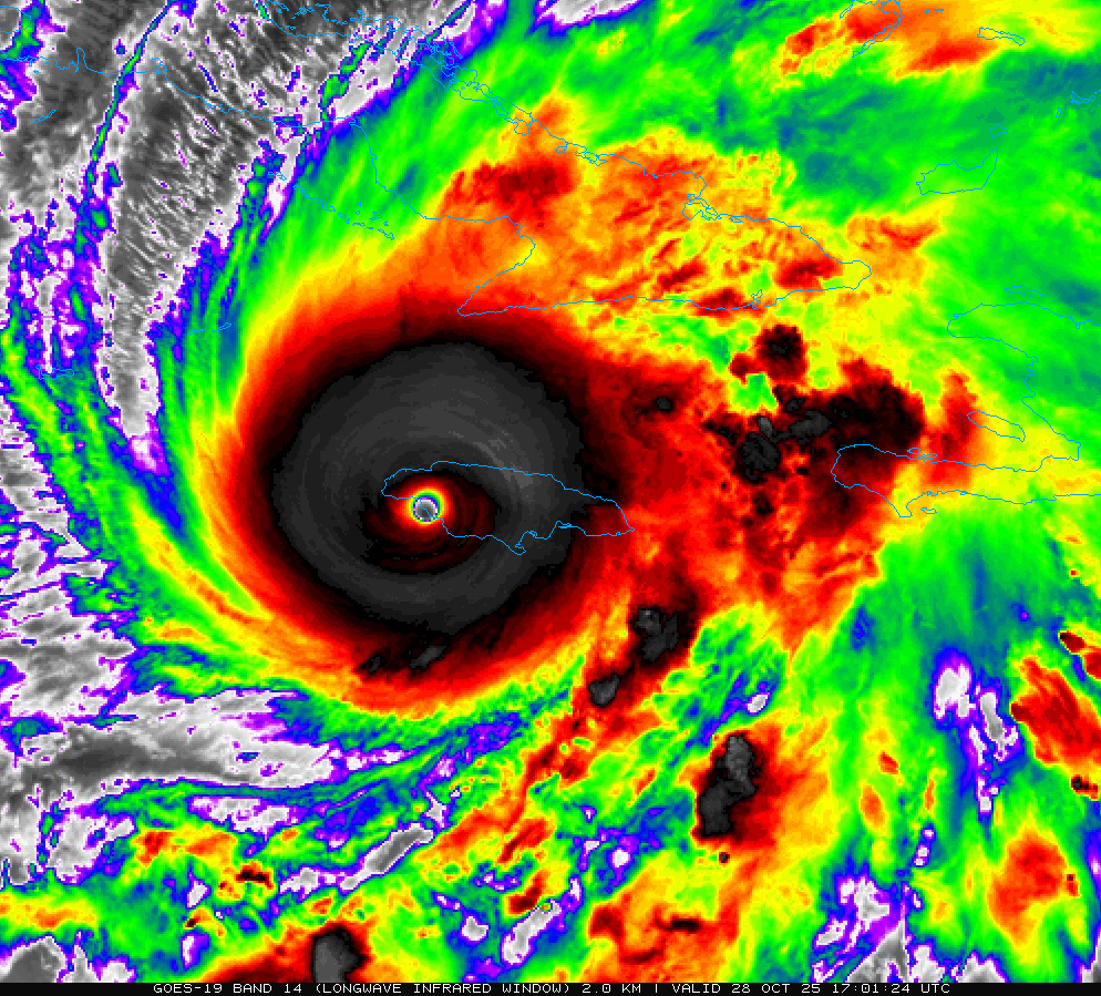
- A 2.75 pound drone flying into hurricane eye walls just proved it can improve intensity forecasts by 10 percent, and this season, that data feeds directly into the models protecting your community.
- NOAA just predicted a below-average hurricane season. The director of the National Weather Service responded with four words: “It just takes one.”
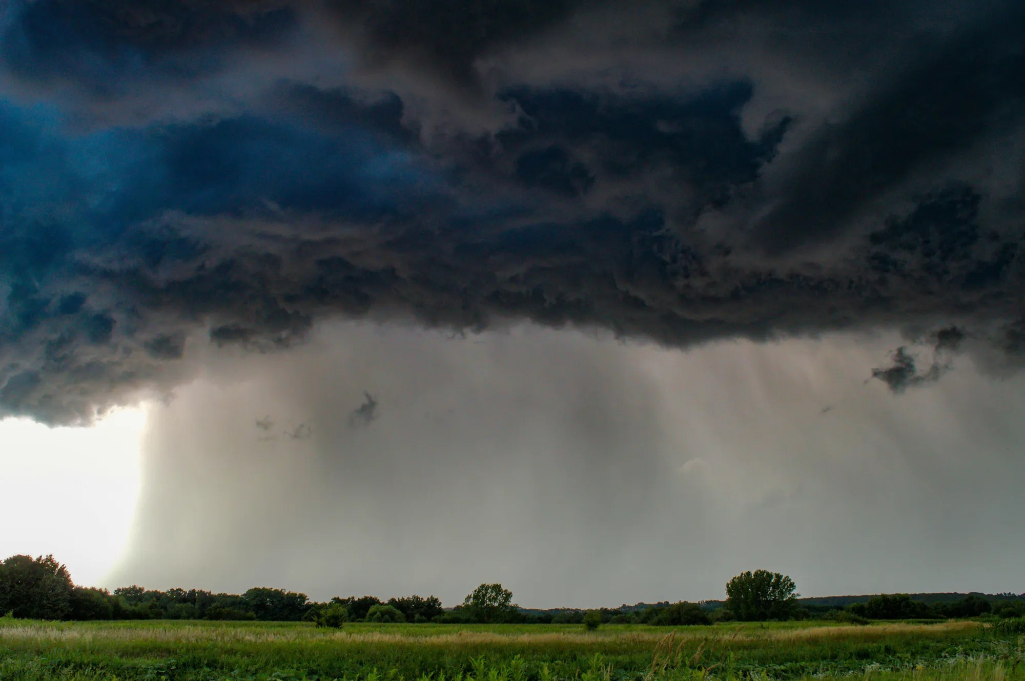
SEVERE WEATHER AND TORNADO SAFETY AND PREPAREDNESS
NOAA WEATHER RADIO
Here’s your weekly reminder to check your NOAA weather radio’s batteries, programming, settings, and reception. NOAA has a comprehensive page on NOAA weather radio…a feature of the National weather Service in the USA that has saved countless lives.

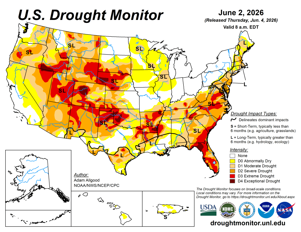
US DROUGHT MONITOR
The drought map shifted this week, but not in everyone’s favor. Repeated storms brought meaningful relief across the South and Southeast, while the northern Plains and upper Midwest saw drought expand under hot, dry conditions. The Northeast was mixed with beneficial rain for New England, but the mid-Atlantic is drying out.
Looking ahead, a slow-moving storm system could deliver over an inch of rain to parts of Iowa and the upper Midwest, but above-normal temperatures and summer agricultural demand will likely consume whatever falls across Illinois, Indiana, and northern Minnesota before it does much good. The West stays mostly dry.
Week 2 brings above normal temperatures nearly coast to coast, with Gulf moisture pushing deep into the central US. That combination could trigger organized storms east of the Rockies, helpful for drought stressed areas if it materializes. The Pacific Northwest leans drier than normal, and concerns are growing about short-term drought returning to the Northeast.
- NOAA’s US Drought Monitor website has the full regional details.
- The latest daily fire weather outlooks can be found at the Storm Prediction Center’s website.
CITIZEN SCIENCE
Citizen science lets everyday people actively shape real research by sharing observations and data. Join now to make a tangible impact, discover new insights, and become part of a global community driving scientific breakthroughs!
- The CoCoRaHS project invites weather enthusiasts to become citizen scientists by submitting daily precipitation reports that support forecasting and climate research even on dry days.
- Another path into becoming a citizen scientist is using the free mPING app! Your weather reports go directly to the National Severe Storms Laboratory in Norman, Oklahoma!
That’s a wrap for this week! Thanks for stopping by! See you next Saturday!
™ Tornado Quest © 1998‑2026 Tornado Quest, LLC. All Rights Reserved.

You must be logged in to post a comment.