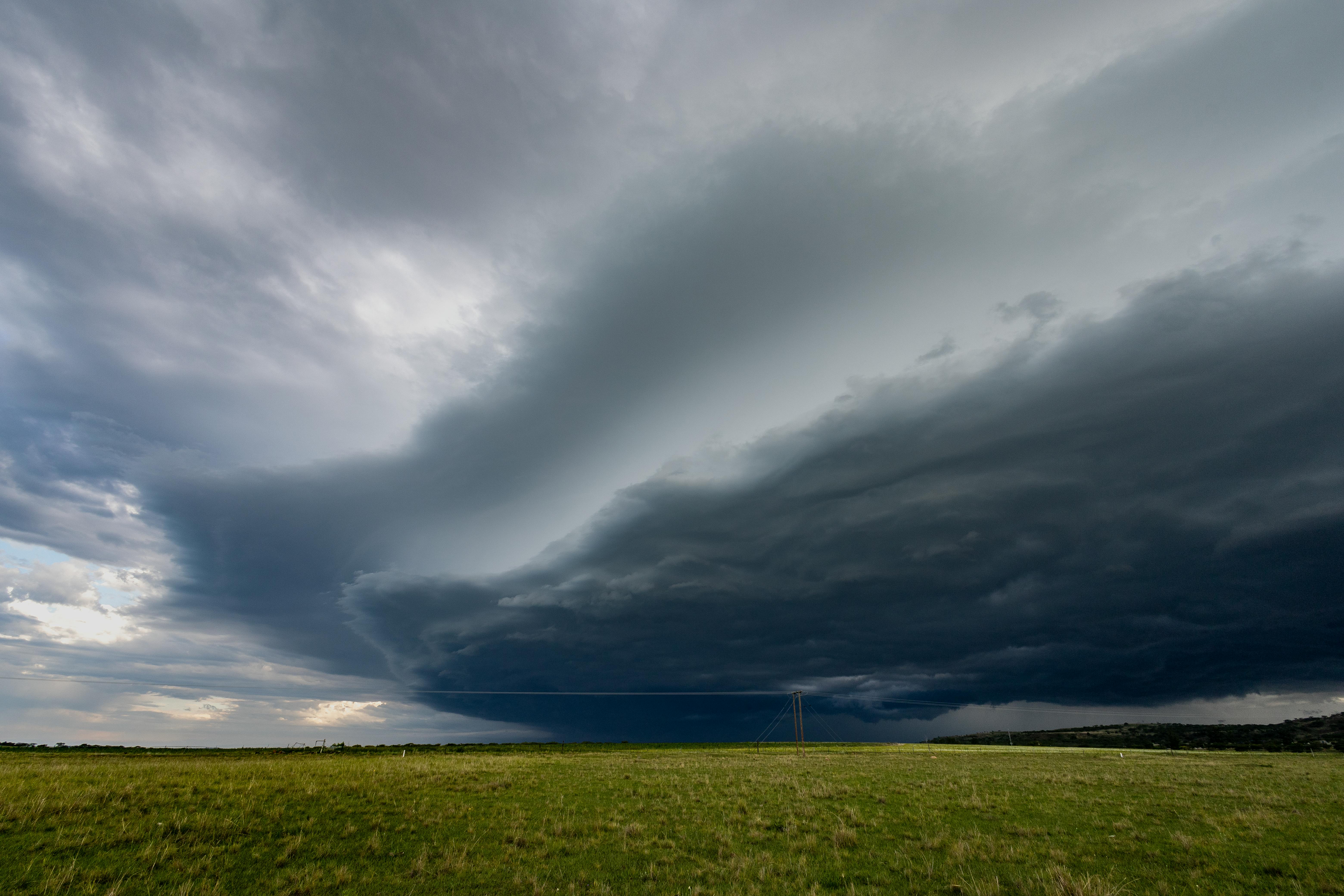
Greetings everyone. I’m glad you’re here. The Atlantic hurricane season is officially here with a warning on complacency regarding this year’s outlook. The severe weather and tornado season isn’t finished either, making your NOAA Weather Radio and preparedness plan as vital in June as they were in April. In this week’s post, you’ll find the updated US Drought Monitor showing the critical western USA water picture heading into summer, a new Tornado Quest Chronicles essay, and a new must-read page on the “Invisible Storm” of summer heat, all alongside essential severe weather safety information and other interesting reads to support you throughout the week. Settle in. We’ve got a lot to cover.
- The World Cup will be the big sports event this summer that was made possible by a great deal of preparation. However, there’s one hazard to players and fans alike that hasn’t been accounted for.
- “Flying blind” is an understatement in this read on how cuts to vital science data will ultimately cost us all.
- Americans spent decades cleaning up the air. A new study just calculated how much of that work wildfires have quietly undone.
- Scientists just built a 17-foot fire tornado on purpose. What it did to a crude oil spill is rewriting how we think about environmental cleanup.
- Some people love the summer heat. Some species thrive in the summer too. But, not everyone or every creature is capable of thriving, or being on their best behavior when it’s stupid hot.
- Summer has arrived with a vengeance across several areas of the Northern Hemisphere. Here’s a very informative site to help you brush up on your summer heat safety info and the latest data for the USA.
- The ocean current that warms Europe and stabilizes global weather was once just the premise of a disaster movie. Scientists just confirmed it’s weakening, and one proposed fix involves building an 80-kilometer dam.
- I’ve been talking about this for months and it’s finally arrived. El Niño is officially here, bringing a strong climate shift that will disrupt global weather and likely push 2026 to become the hottest year on record.
- When doing a tornado path survey, every damaged building and broken tree is essentially forensic evidence. Here’s how meteorologists work a tornado scene like a crime scene to figure out exactly what happened.
- ICYMI: NOAA just predicted a below-average hurricane season. The director of the National Weather Service responded with four words: “It just takes one.”
SEVERE WEATHER AND TORNADO SAFETY AND PREPAREDNESS
THE INVISIBLE STORM
NOAA WEATHER RADIO
Here’s your weekly reminder to check your NOAA weather radio’s batteries, programming, settings, and reception. NOAA has a comprehensive page on NOAA weather radio…a feature of the National weather Service in the USA that has saved countless lives.

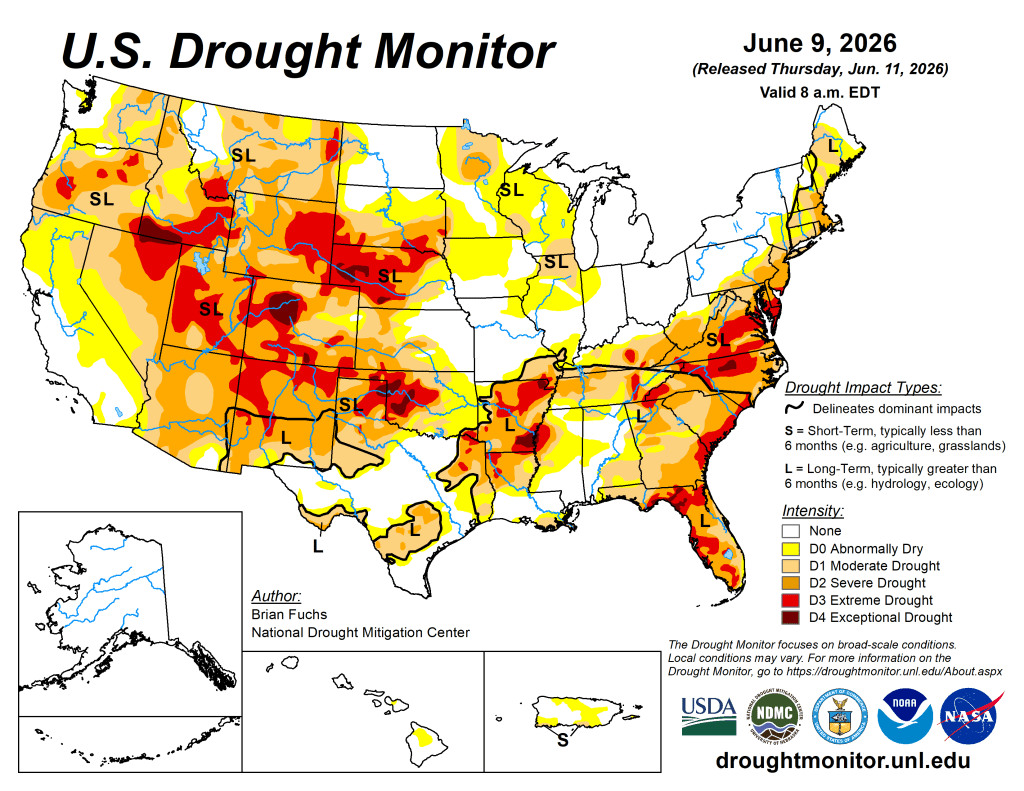
US DROUGHT MONITOR
Summer weather was all over the U.S. map this week, with summer thunderstorms hitting some places hard while others barely saw any rain. The central Plains, parts of Texas, New Mexico, the Midwest, and areas along the Mississippi River got significantly more rain than usual, while the East Coast (except Florida) and most of the western states stayed quite dry. Temperatures were equally inconsistent and much cooler than average in the Southeast (Georgia, Florida, South Carolina), but scorching 9 to 12 degrees above normal across Nebraska and the Dakotas. Drought worries haven’t fully gone away either; even though some wet areas have seen relief, farmers in the Plains are still dealing with impacts on crops, and wildfire risk stays high in places like Florida. Looking ahead, the West will remain hot and dry, especially Nevada and the Pacific Northwest where temperatures could exceed normal by over 10 degrees. Meanwhile, the southern and eastern U.S. have the best chance for continued rainfall, while the northern Plains and upper Midwest are expected to stay drier and cooler than average for the next week or so.
- NOAA’s US Drought Monitor website has the full regional details.
- The latest daily fire weather outlooks can be found at the Storm Prediction Center’s website.
CITIZEN SCIENCE
Citizen science lets everyday people actively shape real research by sharing observations and data. Join now to make a tangible impact, discover new insights, and become part of a global community driving scientific breakthroughs!
- The CoCoRaHS project invites weather enthusiasts to become citizen scientists by submitting daily precipitation reports that support forecasting and climate research even on dry days.
- Another path into becoming a citizen scientist is using the free mPING app! Your weather reports go directly to the National Severe Storms Laboratory in Norman, Oklahoma!
That’s a wrap for this week! Thanks for stopping by! See you next Saturday!
™ Tornado Quest © 1998‑2026 Tornado Quest, LLC. All Rights Reserved.

You must be logged in to post a comment.