No podcast this week, I’m under the weather, quite literally. But the science doesn’t wait, and neither does the world outside your window. Earth’s vital signs are flashing red across multiple fronts simultaneously, a megadrought entering its 27th year may be rewriting what “drought” even means, and the quiet Atlantic hurricane season has an explanation worth understanding before complacency sets in. The US Drought Monitor update is in the post, your NOAA Weather Radio deserves some TLC, and the hurricane safety page is here if you need it with a plethora of potentially life saving information. Eight reads this week. Some frightening, some fascinating, one that will make you look differently at the cleaning products under your kitchen sink. I’ll be back next week, hopefully with an audible voice. Have a great week everyone.
- Deep within a cosmic nursery lurks a cast of celestial oddballs so small and strange they’re forcing astronomers to redraw the boundaries between planets and stars They’re revealed in one of the most detailed space photographs ever captured.
- Outdoor air quality is a topic we frequently explore on Tornado Quest. However, indoor air quality is another frequently overlooked matter. We clean our homes with many products, but what if the very products meant to protect us are quietly polluting the air we breathe inside?
- Australia’s new climate rules force companies to prepare for tomorrow. But what happens when two rivals discover their survival depends on something neither saw coming?
- Earth’s vital signs are flashing red. Seven of nine essential life-support systems have failed, but scientists whisper a shocking possibility: we might still reverse the diagnosis if we act before time runs out.
- This year’s El Nino has had some dramatic effects on our weather and climate. Just how might this change the autumn and winter in your region?
- A twenty-seven year long megadrought has scientists questioning a terrifying possibility. What if this isn’t a drought we wait out, but a permanent new reality?
- One inch of sea level rise seems harmless until you realize 770 million people already live less than five meters above today’s tides and extreme flooding events have jumped twelve-fold in our lifetimes.
- If you’ve heard that the Atlantic has been quiet in terms of hurricane activity, it’s correct. It’s equally important to understand why we’re seeing this quiet period.
HURRICANE SAFETY AND PREPAREDNESS
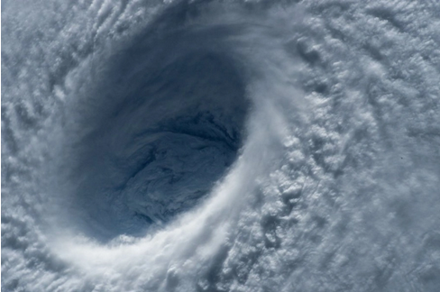
Don’t Let the Quiet Atlantic Fool You: Why Now Is Not the Time to Relax!
While the Atlantic hurricane season in 2026 has been unusually quiet so far with record-low activity and no major storms making landfall, the Pacific tells a dramatically different story. The eastern and central Pacific basins are currently experiencing substantial hurricane activity, proving that global tropical cyclone seasons remain dangerously active even as one ocean sits dormant. This stark contrast underscores a critical lesson: a quiet Atlantic doesn’t signal safety, but rather a shift in where storms are forming. Forecasters attribute this year’s Atlantic calm largely to a strong El Niño, which creates wind patterns that suppress storm development in the basin. However, history reminds us that some of the most destructive hurricanes, like Andrew in 1992, have struck during years when the season seemed slow at first.
The real danger lies not in the numbers, but in the complacency that calm breeds. When one region sits quiet while others churn, it’s tempting to lower guardrails, ignore emergency plans, or divert preparedness resources elsewhere. Yet all it takes is one powerful storm to shatter that sense of security. Hurricane readiness isn’t about how many storms form, it’s about being ready for the one that could hit your community. So while the Atlantic may be quiet now and the Pacific bears the brunt of activity, don’t assume we’re in the clear. Stay prepared, stay informed, and remember: the season isn’t over yet.
US DROUGHT MONITOR UPDATE
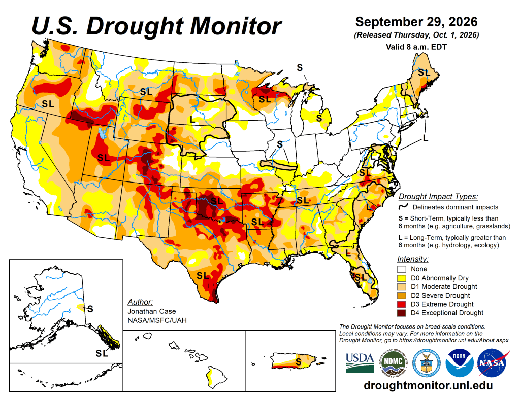
US Drought Monitor Summary
The same weather system that’s finally bringing desperately needed rain to the drought stricken Southwest is heading your way next and potentially relieving water restrictions, lowering fire risk, and easing grocery prices in some regions, while leaving others stuck with scorching heat and drying soils that threaten crops, power grids, and lake levels. As Hurricane Polo’s moisture plows eastward into the Plains and Midwest this week, you might notice thicker clouds and heavier downpours replacing weeks of clear skies, but don’t let that fool you: the western states are bracing for above average temperatures with little rain next week, meaning your neighbors across the Rockies could face renewed wildfire danger and earlier snowpack melt, while the Southeast gears up for its own wet spell that could strain drainage systems and disrupt harvest timing. Whether you’re dealing with irrigation costs, insurance premiums, reservoir levels, or simply planning outdoor activities, these shifting patterns show why drought isn’t just a local issue. Drought ripples through food supply chains, utility bills, and property values wherever you live, making this week’s rain a temporary gift that won’t fix months of accumulated dryness anywhere near fast enough to feel safe.
- NOAA’s US Drought Monitor website has the full regional and state details.
- The latest daily fire weather outlooks can be found at the Storm Prediction Center’s website.
NOAA WEATHER RADIO

Here’s your weekly reminder to check your NOAA weather radio’s batteries, programming, settings, and reception. NOAA has a comprehensive page on NOAA weather radio…a feature of the National weather Service in the USA that has saved countless lives.
THE INVISIBLE STORM
CITIZEN SCIENCE
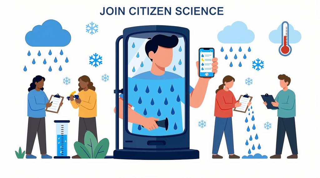
Citizen science lets everyday people actively shape real research by sharing observations and data. Join now to make a tangible impact, discover new insights, and become part of a global community driving scientific breakthroughs!
- The CoCoRaHS project invites weather enthusiasts to become citizen scientists by submitting daily precipitation reports that support forecasting and climate research even on dry days.
- Another path into becoming a citizen scientist is using the free mPING app! Your weather reports go directly to the National Severe Storms Laboratory in Norman, Oklahoma!
- SciStarter is a great place to explore a vast variety of citizen science projects.
- Zoonivese is another website that has a plethora of citizen science projects from climate to astronomy to ecology.
That’s a wrap for this week! Thanks for stopping by! See you next Saturday!
™ Tornado Quest © 1998‑2026 Tornado Quest, LLC. All Rights Reserved.


You must be logged in to post a comment.